The Marion County Transit Plan begins the process of implementing Indy Connect, the long range transportation vision for Central Indiana.
On February 27, 2017, the Indianapolis/Marion County City-County Council approved an dedicated income tax of 0.25% to support improvements to the Indianapolis/Marion County public transportation system, aka IndyGo.
On November 8, 2016, Marion County voters cast their ballots on the following question, supporting it at over 59%:
City-County Council Special Ordinance #1, 2016: Referendum for Transit Funding
Shall Marion County have the ability to impose a county economic development income tax rate, not to exceed a rate of 0.25%, to pay for improving or establishing public transportation service in the county through a public transportation projectthat will create a connected network of buses and rapid transit lines; increase service frequency; extend operational hours; and implement three new rapid transit lines?
This referendum asked voters if they wished to spend 25¢ for every $100 of earned income for a dedicated transit fund to implement the Marion County Transit Plan. This referendum was advisory and the Indianapolis/Marion County City-County Council approve the funding on February 27, 2017.
Based on years of planning with the support of the Metropolitan Planning Organization (MPO) and Central Indiana Regional Transportation Authority (CIRTA), the Marion County Transit Plan is a detailed investment plan for mass transit, including improvements such as:
- Buses coming more often on all routes
- Less waiting for passengers
- Longer hours of service: early morning to late night
- Every route running on every day of the week
- Improved grid pattern for faster travel times and more efficient transfers
- Rapid transit lines (Red*, Blue, and Purple) along high ridership corridors
(*The Red Line from Broad Ripple to the University of Indianapolis is already funded with a federal grant.)
For more information about the Marion County Transit Plan, and to stay informed about public meetings and other opportunities to provide feedback into the plan, visit the project website at www.IndyGo.net/TransitPlan.
The following are materials that were used during the public education and engagement process.
 Marion County Transit Plan
Section 3: The Marion County Transit Plan, of the larger Central Indiana Transit Plan.
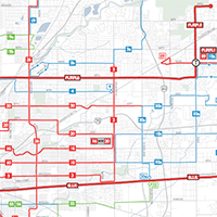
 Marion County Transit Plan 2021 System Map
This map shows the proposed system for 2021. In the map, red routes have buses coming every 15 minutes or better, blue routes are every 30 minutes, and green routes are every 60 minutes.
 Marion County Transit Plan Handouts
(PDF) … (11″x17″ Folder PDF) … (Audio) … (Espanol)
These handouts include maps of the existing and future system, national transit system rankings, funding and costs, key dates, and other useful information.
 MARION COUNTY TRANSIT PLAN DOT DENSITY MAPS
These maps illustrate the proposed service in the Marion County Transit Plan in terms of who the proposed routes and increased frequencies would serve.
 MARION COUNTY TRANSIT PLAN 18″x28″ POSTER
This 18″x28″ informational poster includes only the facts of the plan and is perfect for posting in community centers, businesses, and other places.
 MARION COUNTY TRANSIT PLAN PRESENTATION
This presentation has been given to many community groups and organizations to discuss the highlights of the Marion County Transit Plan.
 MARION COUNTY TRANSIT PLAN PRESENTATION BOARDS
These boards are used at public meetings.
 Upcoming Events
Check out upcoming opportunities to learn more about the Marion County Transit Plan!
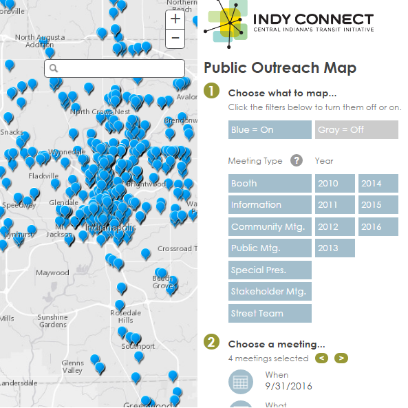
 Where We’ve Been
A map of Indy Connect meetings from 2010 through 2016.
 What About My District?
Check out this document illustrating how transit service today would compare to service in the Marion County Transportation Plan for each Marion County City-County Council District.
 What’s on the Ballot?
This video was created to help people understand what would be on the ballot on November 8th, 2016 for the Marion County Transit Plan.